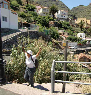
We caught the 09.10 line 6 bus from Vueltas on 12 June with the intention of climbing the Fortaleza tabletop hill and then hiking via Igualero to Mt Garajonay, the highest peak on La Gomera. However on reaching the level of the Laurelsilva forest, we entered the cloud, visibility dropped to a few meters and it started to rain. So had a rething about our plans and decided to try a lowere level hike. So we stayed on the bus until we had dropped low enough to be out of the cloud and got out at Antoncojo, a small village at an altitude of 500 meters. Our hiking map showed that the LG 15.1 trail passed close by. However, our walking guide did not include this so we had no good information on the route. 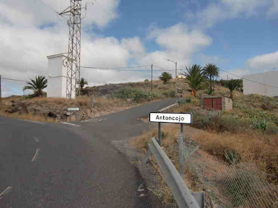 After a short walk along the access road, we reached the village of Antoncojo
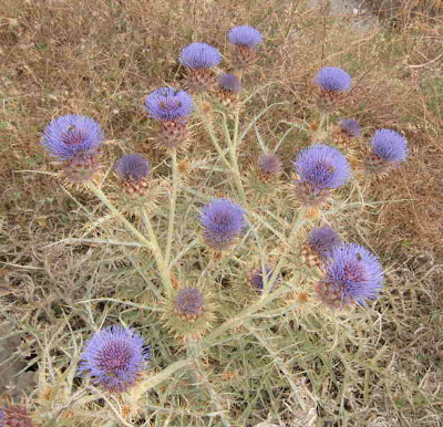
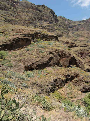
 Couldn't resist taking this shot of some thistles
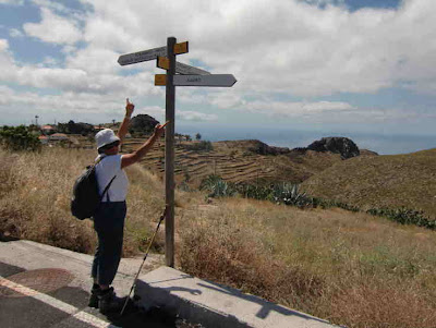
 In the middle of the village we were relieved to find a sign to the LG 15.1

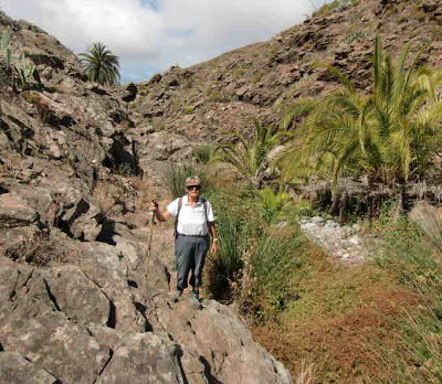
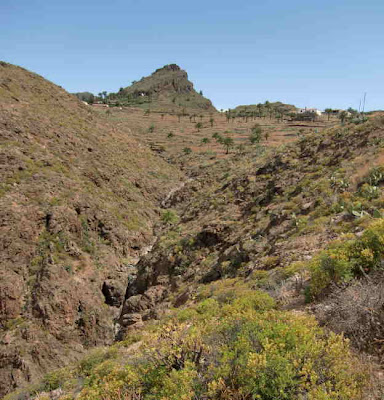
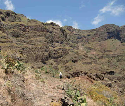
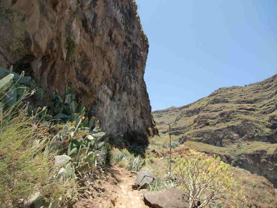
 The trail led up the barranco
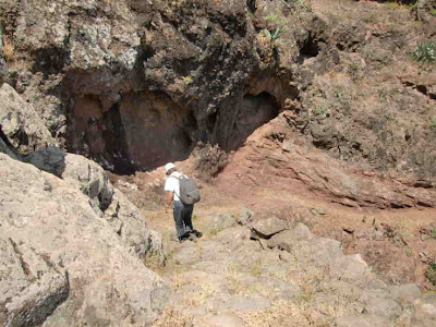
 past an almost vertical water channel from water was pouring
 We lost the trail for a while
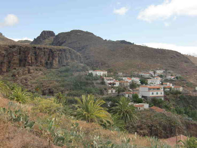
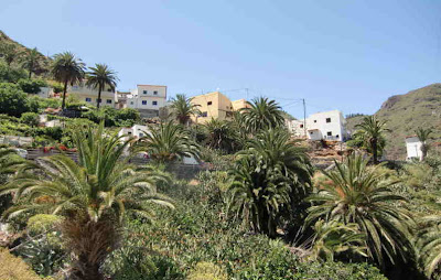
 then refound it and made our way up to the village of Targa, 740 meters above sealevel.
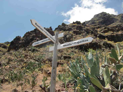
 where we found the sign to LG 15 direction Imada - we were now on Rother Walking Guide route 9, the Barranco de Guarimar.
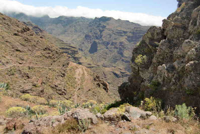
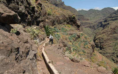
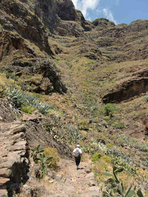
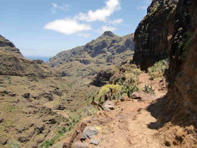
 Not far from the village, the trail suddenly reached the top of the cliff dropping vertically into the the Barranca Guarimar giving spectacular views
 What we had not realised before deciding to do this hike was that the trail drops steeply from Targa (740 m) to Guarimiar (370 m ) before climbing back up to Imada at 870 meters - we took it very slowly to preserve our knees.


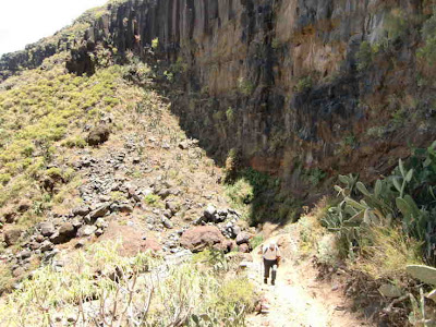
 In general, the trail was in excellent condition.
 A seemingly fairly recent rockfall partly blocked this part of the descent
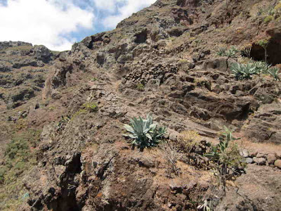
 Below the trail a levada water channel clings to the cliff
 The trail briefly follows a levada
 Split in the trail

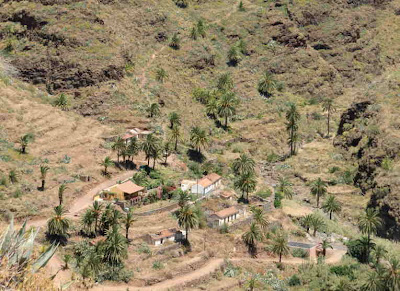
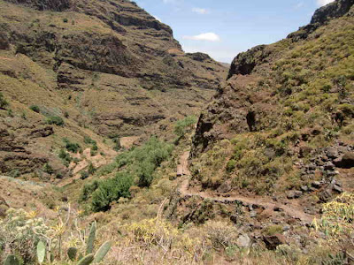
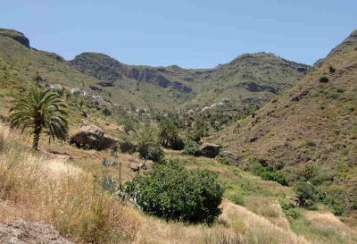
 The lowest point of the trail, the hamlet of Guarimiar comes into view
 The trail splits at Guarimiar. Our trail now starts climbing to Imada
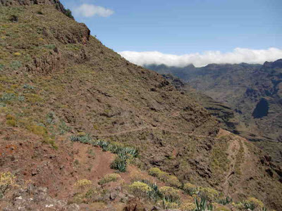
 The trail uses several natural ledges
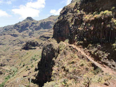 Some of the ledges are narrow and quite exposed

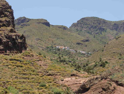
 Our end destination, the village of Imada comes into view
 Made it to Imada ! - however a steep 30 minute climb up the road awaits before we get to the bus stop.
 Made it to the bus stop in time to catch the line 6 bus at 16.40hrs.
 After a short walk along the access road, we reached the village of Antoncojo
 Couldn't resist taking this shot of some thistles
 In the middle of the village we were relieved to find a sign to the LG 15.1
 The trail led up the barranco
 past an almost vertical water channel from water was pouring
 We lost the trail for a while
 then refound it and made our way up to the village of Targa, 740 meters above sealevel.
 where we found the sign to LG 15 direction Imada - we were now on Rother Walking Guide route 9, the Barranco de Guarimar.
 Not far from the village, the trail suddenly reached the top of the cliff dropping vertically into the the Barranca Guarimar giving spectacular views

 What we had not realised before deciding to do this hike was that the trail drops steeply from Targa (740 m) to Guarimiar (370 m ) before climbing back up to Imada at 870 meters - we took it very slowly to preserve our knees.


 In general, the trail was in excellent condition.
 A seemingly fairly recent rockfall partly blocked this part of the descent
 Below the trail a levada water channel clings to the cliff
 The trail briefly follows a levada
 Split in the trail
 The lowest point of the trail, the hamlet of Guarimiar comes into view


 The trail splits at Guarimiar. Our trail now starts climbing to Imada


 The trail uses several natural ledges
 Some of the ledges are narrow and quite exposed
 Our end destination, the village of Imada comes into view


 Made it to Imada ! - however a steep 30 minute climb up the road awaits before we get to the bus stop.
 Made it to the bus stop in time to catch the line 6 bus at 16.40hrs.
1 comment:
We hebben weer genoten van de foto's en de beschrijving en hebben diep respect voor jullie klimgeit-wandelingen , die zullen we nooit meer kunnen doen maar we genieten met jullie mee , elke keer weer. Grtjs LNG
Post a Comment